")
support@meisterdrucke.com · 0043 4257 29415


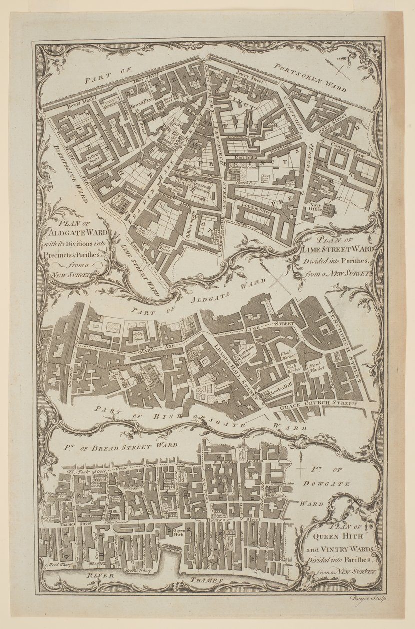
'Plan for Queen Hith og Vintry Wards delt inn i prestegjeld fra en ny undersøkelse'. Kart over City of London av Royce som viser Leadenhall Street og East India House('Plan of Queen Hith and Vintry Wards divided into Parishes from a New Survey'. Map of the City of London by Royce showing Leadenhall Street and East India House)English School |
|
€ 115.68
Enthält 0% MwSt.
|
|
Udatert · engraving
· Bilde ID: 1425882
British Library, London, UK / Bridgeman Images |
| 0 Vurderinger |


.jpg "Kirke og hytte med opplyste vinduer")
.jpg "The Nonpareil med portretter av dronning Victoria og prins Albert")
.jpg "Kvinne som slår mannen sin med en sko")
.jpg "Portrett av en kroppsbygger, ca. 1898")
.jpg "Engelsk Rose")
.jpg "Engelsk Rose")
.jpg "Lavater Lee og sønner, akrobater")
.jpg "The")
.jpg "Flott grønn trefrosk")
_-_(MeisterDrucke-1008944).jpg "Elefant (farget gravering)")
.jpg "Princes Street Edinburgh - West End")
.jpg "Roman Augurs")
.jpg "Utsikt over Akropolis i Athen")
.jpg "Skip ankommer")
_-_(MeisterDrucke-1421446).jpg "Kart over Europa i 1910 (farge litho)")
.jpg "Komposisjon med stort rødt plan, gult, svart, grått og blått, 1921")
.jpg "Den store bølgen i Kanagawa")
.jpg "Valmue feltet")
_1898-1901_-_(MeisterDrucke-805086).jpg "Der vierte Stand (Den fjerde stand). 1898-1901")
.jpg "Stakkars dikteren")
.jpg "Kvinne ved vinduet")
.jpg "Utsikt over Naruto-boblebadene ved Awa, fra serien")
.jpg "Utsikt over Dents-du-Midi fra Champéry")
.jpg "The Great Wave off Kanagawa fra fra serien")
.jpg "Valmuene i Argenteuil")
.jpg "Vannliljedammen om kvelden")
.jpg "Bokormen, ca. 1850")
.jpg "Stripete kanne med vårblomster, 1992")
.jpg "Skilpaddetreneren")
.jpg "Verdens opprinnelse")